
Indigenous Culture
Warning: Aboriginal and Torres Strait Islander people are respectfully advised that this site and linked production contains images, video and audio of people who have passed away. Their contribution and legacy is valued and continues to inform the City’s initiatives.
|
The City of Perth kaditj kalyakool moondang-ak kaaradj midi boodjar-ak ngala nyininy, Wadjuk Noongar yoongar wer bandany Aboriginal yoongar yooarme boodjar-ool. Ngalang kaditj Birdiya koora wer yeyi moondang-ak kaaradjiny. |
The City of Perth acknowledges the traditional custodians of the land we are situated on, the Whadjuk people of the Nyoongar nation and Aboriginal people from other lands. We celebrate the continuing traditions, living culture, and the spiritual connection to Boorloo (Perth) and the Derbal Yerrigan (Swan River). We offer our respects to Elders past and present. |
Perth City is located in the ancient country of the Whadjuk Nyoongar people, who have been the Traditional Owners of the south west of Western Australia for at least 45,000 years. The geographical features and natural environment that was fundamental to Nyoongar culture and sustenance, has been substantially transformed by development of Perth City over the last 200 years.
At the time of European settlement in 1829, areas surrounding what is now central Perth were known as Mooro, Beeloo and Beeliar by the Nyoongar nation – the Aboriginal peoples of the south-west of Western Australia. The Whadjuk Nyoongar, as the Traditional Owners of these lands, overlaid a rich culture into these places, which provided for everyday life.
The river is a sacred place for Nyoongar peoples and they preserved many stories of the Waugal, a water-serpent understood to be responsible for the creation and maintenance of the river and most of the water features around Perth. The Nyoongar peoples moved with the seasons, travelling inland in winter, then returning in late spring to capture game such as wallabies, kangaroos and possums. A main camp site was at what is now known as Kings Park (Mooro Kaarta). Aboriginal peoples also frequented the mud flats (Matagarup) which later became Heirisson Island as it was a productive fishing spot.
The Nyoongar peoples had contact with various seafaring visitors including the Dutch and the French before the arrival of Captain James Stirling who colonised the region for the British in 1829. Relations between the settlers and the Aboriginal peoples were not always harmonious as the latter were dispossessed of their land and subjected to sometimes harsh and unsympathetic colonial rule. Fast forward to December 2009 when the State Government signed a framework agreement with the representative body, the South West Aboriginal and Land and Sea Council, aimed at resolving through negotiation six Nyoongar Native Title claims over Perth and the south-west of Western Australia. The City is working closely with its Aboriginal community to deliver 71 actions in the City’s Reflect Reconciliation Action Plan which aim to build respect, relationships and opportunity with the Aboriginal and Torres Strait Islander communities.
-
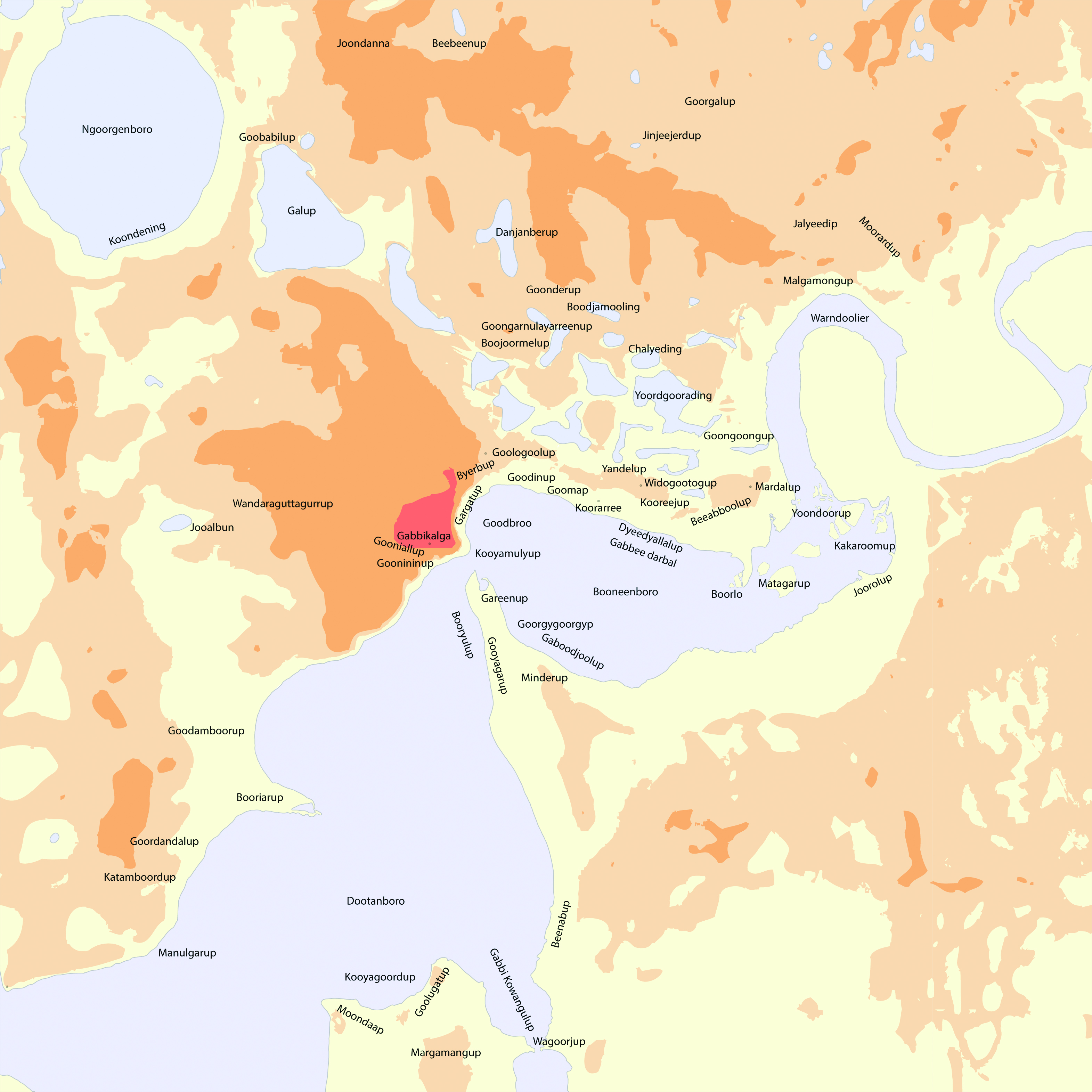
Registered Aboriginal Heritage Sites
There’s many places across Perth that are of cultural and spiritual significance for the Whadjuk Nyoongar people. Places linking the past to the present of where Whadjuk Nyoongar people met, camped, hunted and performed ceremonies. In 2016, the 18 sites below were registered under the Aboriginal Heritage Act 1972 in Perth city.
The 18 sites are listed below:
Site Location Significance Site3502 LocationKings Park Scarred Tree SignificanceModified Tree Site3536 LocationSwan River SignificanceMythological Site3589 LocationHeirisson Island SignificanceMythological, Camp, Hunting Place, Meeting Place, Plant Resource Site3593 LocationGudinup SignificanceCeremonial Site3694 LocationClaisebrook Camp SignificanceCamp, Water Source Site3703 LocationSpring Street SignificanceCamp, Named Place, Water Source Site3704 LocationKings Park Waugal SignificanceCeremonial, Mythological, Plant Resource, Water Source Site3754 LocationMt Eliza Waugal SignificanceMythological Site3761 LocationKings Park SignificanceCeremonial, Hunting Place Site3767 LocationEast Perth Power Station SignificanceCamp, Meeting Place Site3787 LocationMounts Bay Road SignificanceMythological, Camp, Named Place, Water Source Site3789 LocationPerth Town Hall SignificanceCamp Site3791 LocationMatilda Bay SignificanceCeremonial, Camp, Water Source Site3798 LocationGovernment House SignificanceSkeletal Material / Burial, Camp, Water Source Site3799 LocationVictoria Square SignificanceSkeletal Material, Burial Site21621 LocationKilang Minangaldjkba SignificanceWater Source Site29278 LocationMidgegooroo’s Execution and Burial SignificanceHistorical, Skeletal Material / Burial Site37452 LocationWellington Square, the Old Recreation Reserve, Bunjie Park SignificanceHistorical, Man-Made Structure, Rock shelter, Meeting Place Find more information about Aboriginal Heritage Sites across Western Australia.
-
Walking Trails
Karla Yarning: Stories Of The Home Fires
The Karla Yarning Aboriginal heritage maps allow people to discover the connection Aboriginal people have with the city. The maps take people on a journey to discover and learn the importance Aboriginal heritage holds in the history of our city.
The first map, This City is Whadjuk Country, explores Whadjuk Noongar history before the arrival of white settlers in 1829. On this walk, you will explore areas of importance before white settlement and get a feel for the way Whadjuk people lived, traded, hunted, harvested and conducted ceremonies.The second Karla Yarning map, Fighting for Families, Country, Rights and Recognition, explores Aboriginal history in Perth after 1829. On this walk, you’ll learn about important events and developments including the resistance of Whadjuk leaders Midgegooroo and his son Yagan in the 1830s, the Prohibited Area zone in place between 1927-1954, Aboriginal protest rallies held in the 1930s and 1940s and the establishment of important Aboriginal organisations.
The walks take approximately 1.5 hours each.
The maps were initiated, researched and written by Professor Len Collard of UWA and Dr Tod Jones of Curtin University with input and advice from Cultural Advisors. The City would also like to acknowledge the project partners: Lotterywest, The Department of Planning Lands and Heritage and Curtin University. -
Fanny Balbuk Yooreel
In September 2016, the City partnered with the National Trust of Western Australia to deliver a project honouring the life of Whadjuk woman Fanny Balbuk Yooreel.
Balbuk was passionate about her country and ‘raged and stormed’ through her homelands as colonial Perth developed. Her story highlights the intersection of colonisation and the local Aboriginal people in 19th century Perth and how this manifested in the social, political and natural landscape. Throughout April and May 2017, this collaborative project delivered a suite of publicly accessible activations for the 2017 National Trust Heritage Festival, including publication of a walking trail brochure.
Through following the walking trail brochure, participants can walk the path of Fanny Balbuk Yooreel through the Perth landscape and connect to this Perth city in new ways. Guided by Whadjuk Elder women and their extended families, the map provides an experience informed by newly compiled research to mark the 110th anniversary of the death of arguably Perth’s most important and uncelebrated Whadjuk woman.
The information in this map was compiled through the Department of Aboriginal Affairs, ARC Centre of Excellence for the History of Emotions and the National Trust of Western Australia in partnership with the City of Perth.
-
Aboriginal Culture through Public Art
The City of Perth regularly commissions Public Art in civic squares, streetscapes, parks and laneways, recognising that the successful integration of site-specific art enhances the enjoyment of the city experience.
The City features many artworks which celebrate and acknowledge aboriginal culture, storytelling and traditions with those listed below being owned or managed by City of Perth.
The City’s recently revised Art City Walking Trail features two Aboriginal artworks; First Contact (2015) by Laurel Nannup and Koorden (2015) by Rod Garlett, Fred Chaney and Richie Kuhaupt.
For further information on any of the City’s works created by Aboriginal Artists please email our City of Perth Cultural Collections Team: Collections@cityofperth.wa.gov.au
Download
- Welcome to Country - Guidelines and Protocols for External Stakeholders2.75 MB | PDF Document
- This City is Whadjuk Country Walking Trail6.8 MB | PDF Document
- Fighting for Families, Country, Rights and Recognition Walking Trail7.37 MB | PDF Document
Artwork credit |
|
Description of artwork |
|
Location |
|
GPS location |
||
 |
Yagan: Robert Hitchcock (1984); City of Perth Cultural Collections. Image courtesy of Frances Andrijich Photography for Perth Public Art Foundation. | Yagan was born circa 1795 and died in July 1833. He was a Whadjuk Noongar man and a resistance fighter during the early years of the Swan River Colony. In the conflict that ensued, Yagan was both feared and admired by Europeans as a freedom fighter defending his land. Today, Yagan is an iconic figure in the fight for Noongar rights and recognition. | Heirisson Island, western end, south of Causeway | -31.967940, 115.876628 | ||||
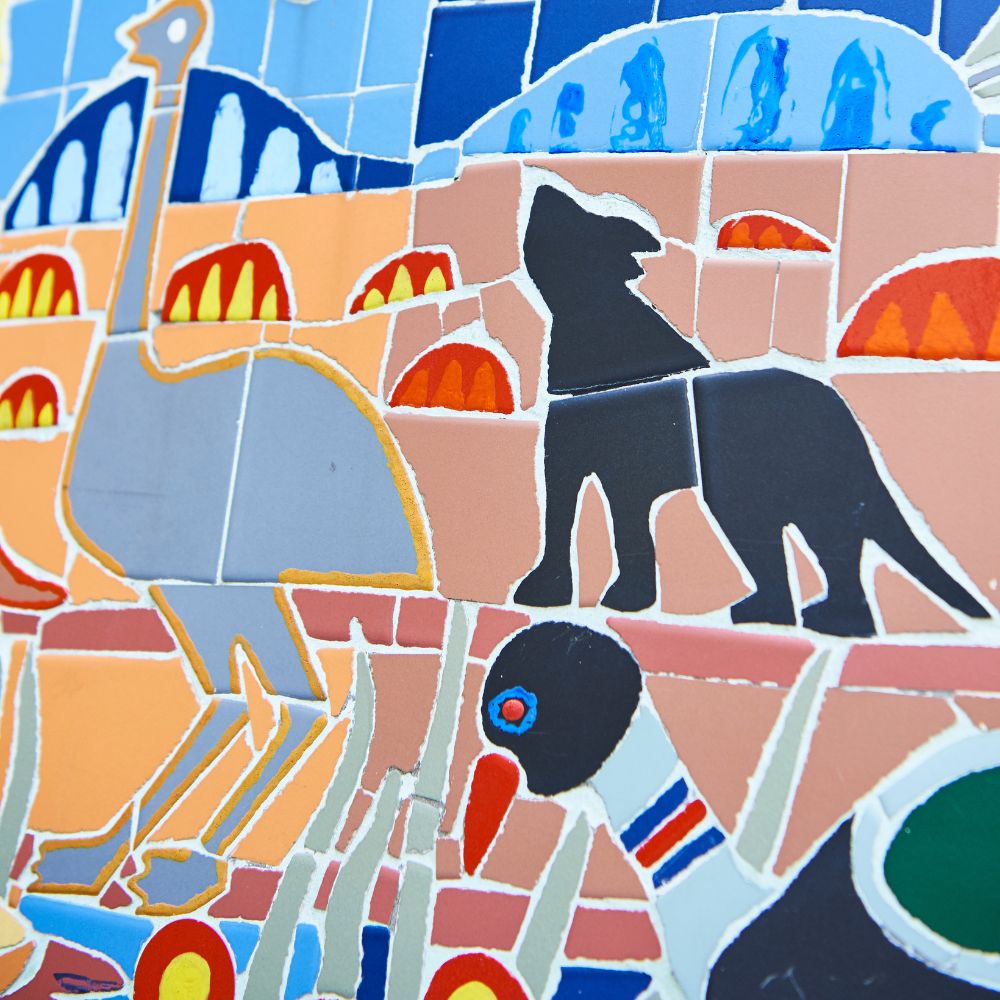 |
Untitled (detail): Toogaar Morrison and John Burgess, (1994); City of Perth Cultural Collections. Image courtesy of Frances Andrijich Photography for Perth Public Art Foundation. | Constructed from a variety of multicoloured tiles, this artwork depicts natural Australian landscapes, flora and fauna. | Citiplace complex, eastern access way, curved wall balustrade | -31.957835, 115.861476 | ||||
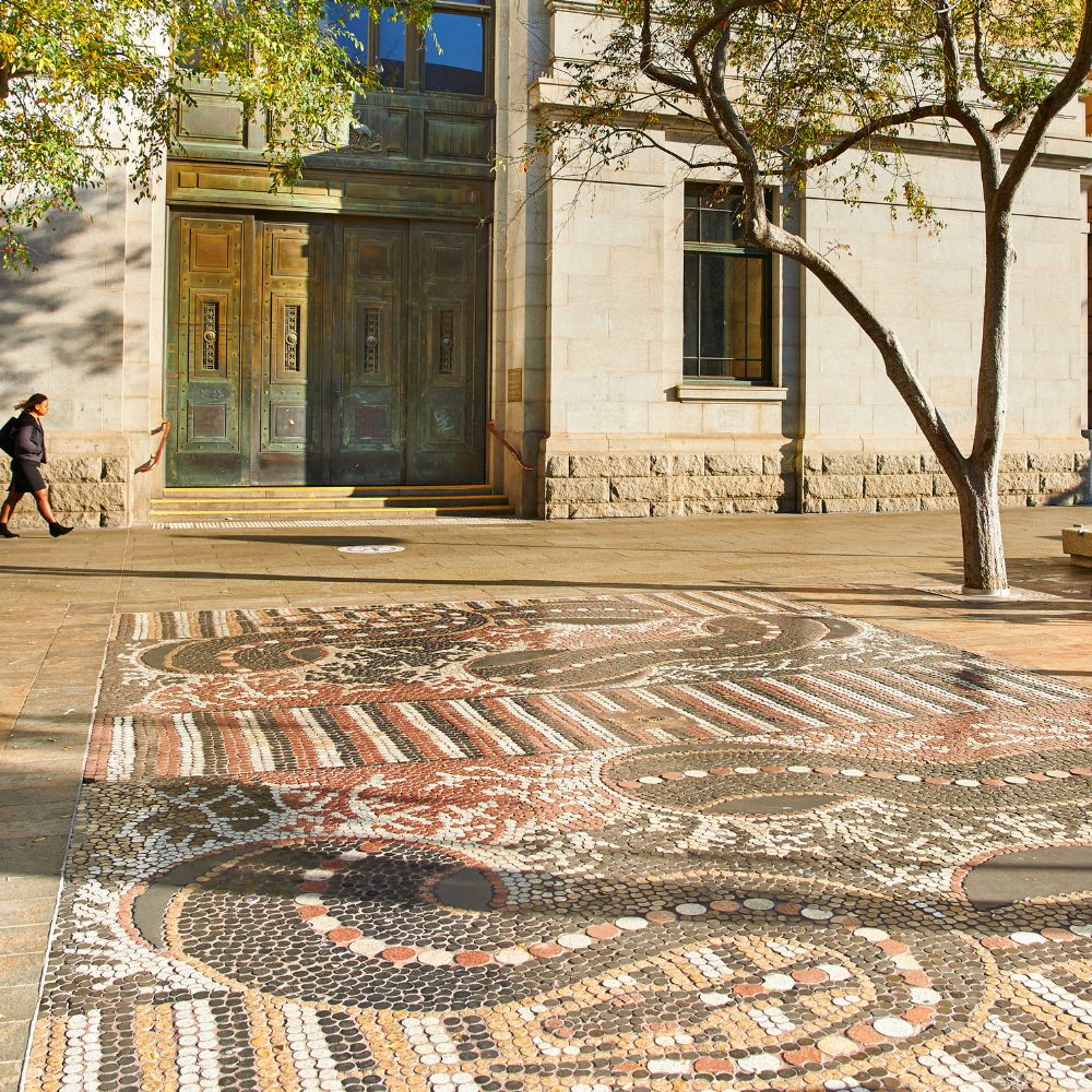 |
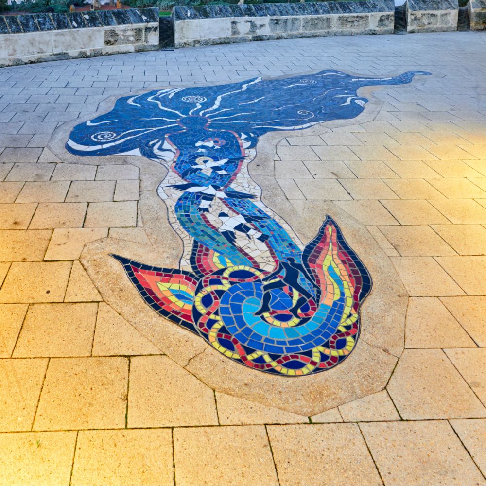
Two Fighting Snakes by Matthew Gill Tjupurulla (1994); City of Perth Cultural Collections. Image courtesy of Frances Andrijich Photography for Perth Public Art Foundation. | This large mosaic artwork depicts two snakes fighting over two Tjupurulla men at the homeland of the artist’s father near Lake Mackay in WA’s Northwest. The original design was translated from a dot painting created by the Balgo Hills artist in 1988. The painting is part of the City of Perth Art Collection. | Southwest corner, near Murray Street Mall | -31.952715, 115.859080 | ||||
 |
Charnock Woman by Miv Egan, Jenny Dawson and Sandra Hill (1996); City of Perth Cultural Collections. Image courtesy of Frances Andrijich Photography for Perth Public Art Foundation. | The East Perth foreshore was a meeting and camping place for the Noongar people. The Charnock Woman ceramic mosaic tells the Noongar Dreaming Story of a giant evil spirit woman, known as the Charnock woman, who stole children from the community. | Eastern Observatory, Victoria Gardens, East Perth | -31.952273, 115.881474 | ||||
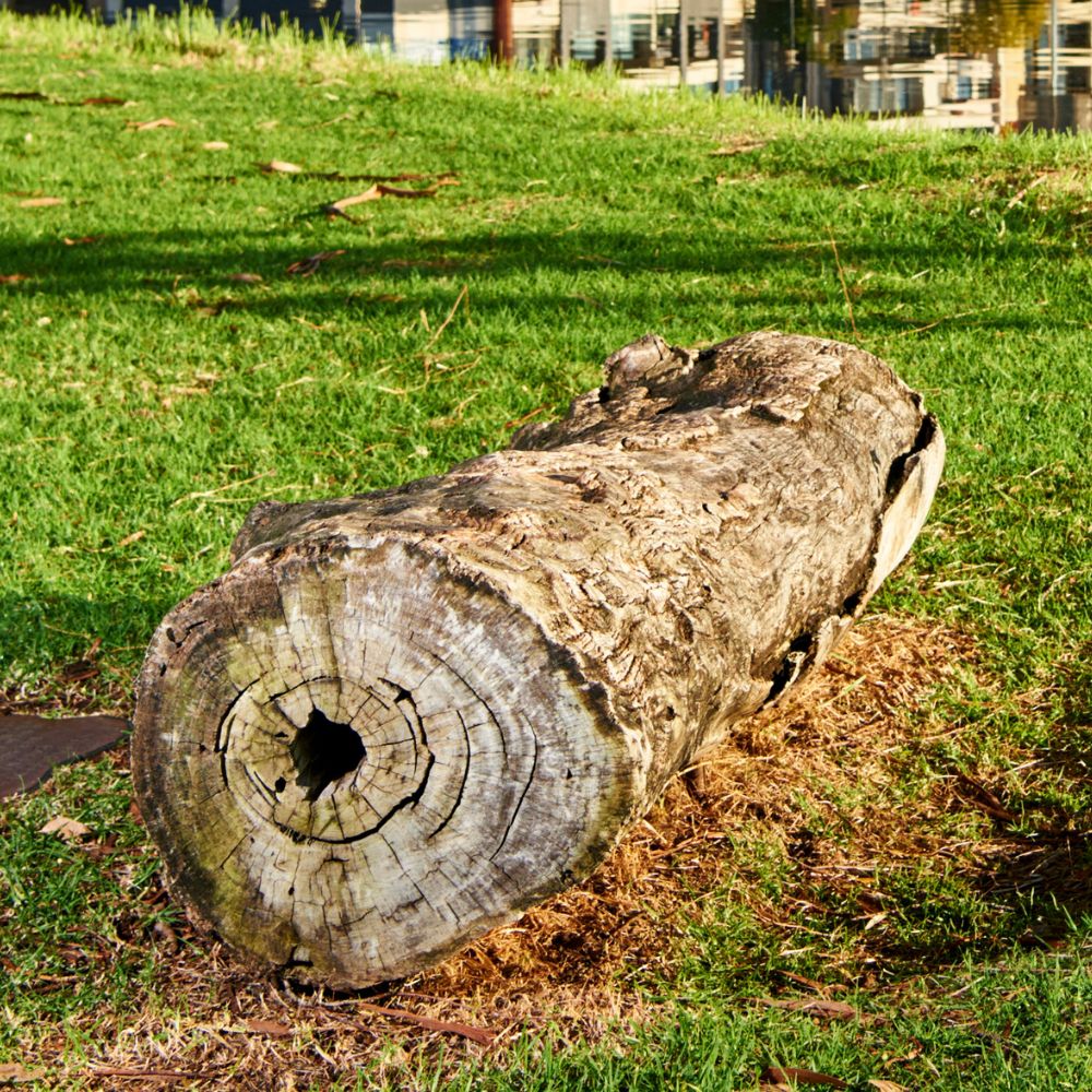 |
Yoondoorup Boorna: Log and Saddle (detail) by Alma Toomath (1996); City of Perth Cultural Collections. Image courtesy of Frances Andrijich Photography for Perth Public Art Foundation. | This old river gum, removed as part of the redevelopment of the East Perth area, was treated and returned to the site at the request of the Noongar people. Its burnt and split trunk was used as a hiding place for goods and messages by those who once camped here. In 2014 the tree saddle was destroyed by fire leaving only the log and plaque. | Royal St, East Perth | -31.951956, 115.881951 | ||||
 |
Illa Kuri Sacred Dreaming Path: Toogaar Morrison (1996); City of Perth Cultural Collections. Image courtesy of Frances Andrijich Photography for Perth Public Art Foundation. | The Illa Kuri public artwork represents the winding pathway that stretched across the landscape before the city was built. The path led from one freshwater lake to another, represented by the twelve granite rocks that stand as silent sentries with the names of the lakes and totems as guides. | Swan River foreshore, north eastern corner of Victoria Gardens, East Perth | -31.952024, 115.881772 | ||||
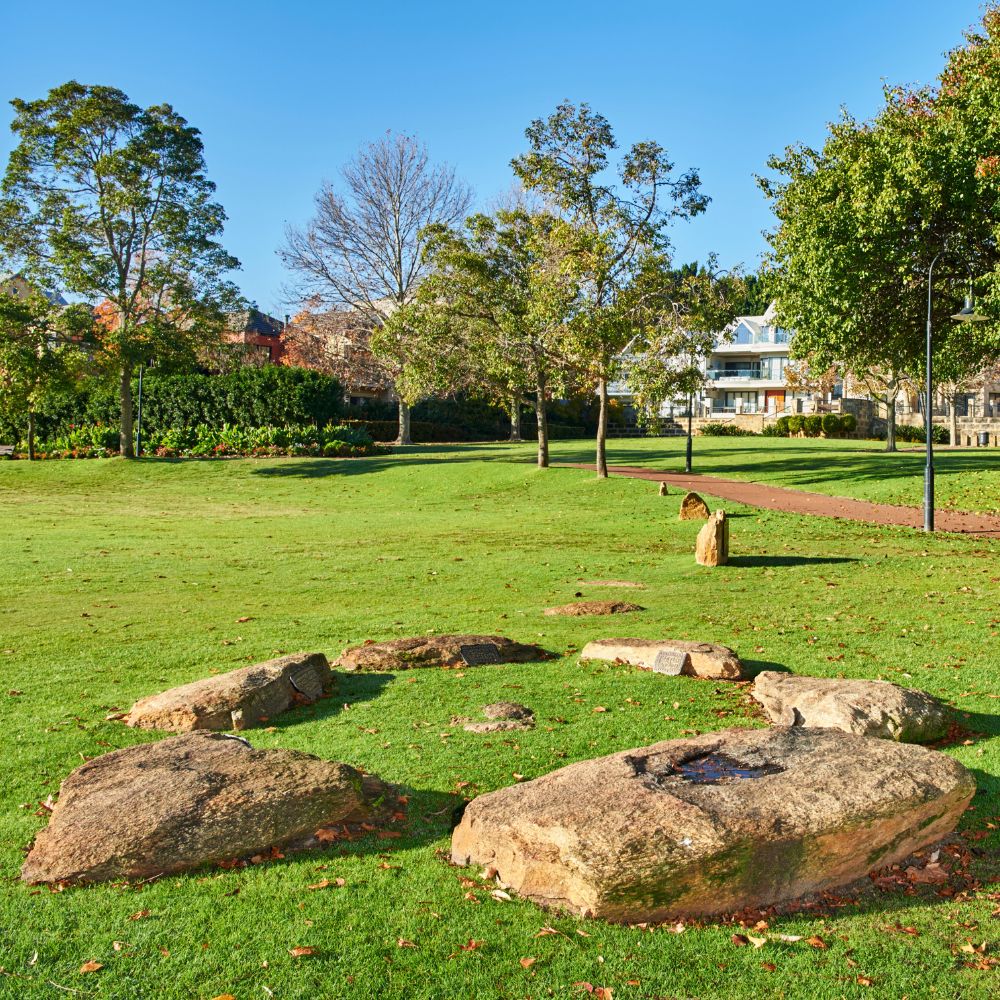 |
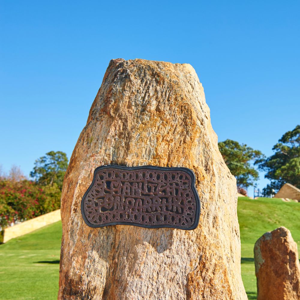
Stone Circle: Toogaar Morrison (1996); City of Perth Cultural Collections. Image courtesy of Frances Andrijich Photography for Perth Public Art Foundation. | This artwork commemorates the six Aboriginal communities established along the Derbarl Yerrigan (Swan River) when Europeans arrived. Each stone is associated with a plaque on which a name has been added. | Western end of Victoria Gardens, East Perth | -31.952625, 115.880691 | ||||
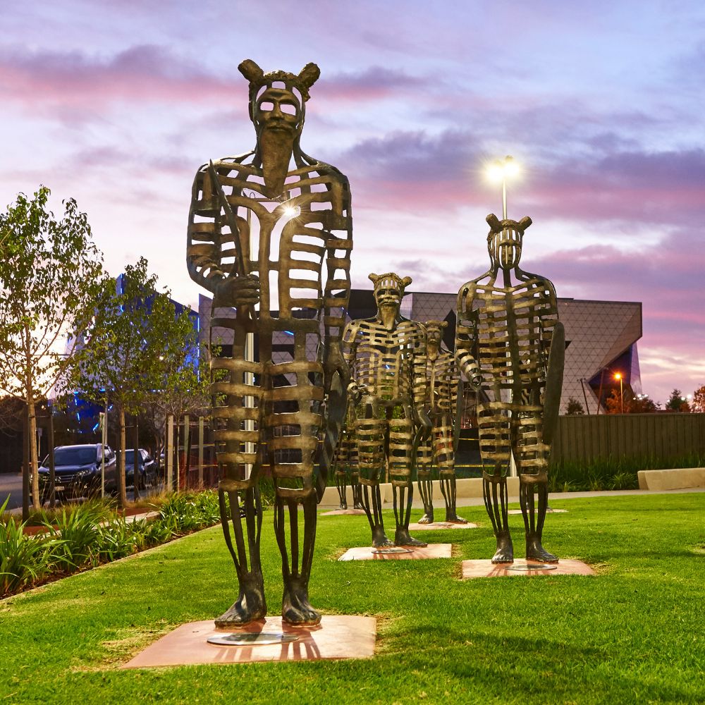 |
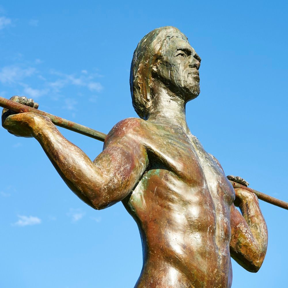
Koorden: Rod Garlett, Richie Kuhaupt and Fred Chaney (2015); City of Perth Cultural Collections. Image courtesy of Frances Andrijich Photography for Perth Public Art Foundation. | Composed of six dramatic figures rendered in cast bronze, these powerful skeletal male figures face east, striding across the grass of Wellington Gardens. The designs originally stem from painted ceremonial markings found in historical photographs and have been reinterpreted by Rod Garlett in extensive consultation with elders in the local Aboriginal community. | Southern edge of Wellington Gardens, Kings Square | -31.949252, 115.854999 | ||||
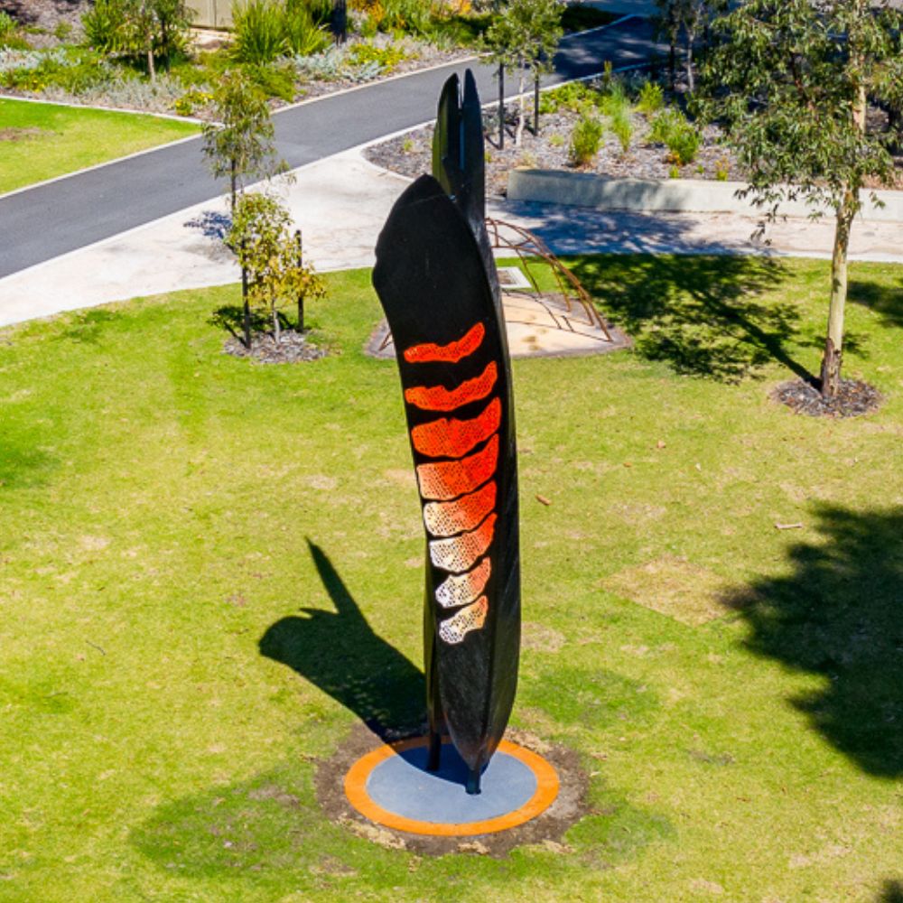 |
Mia Mias: Sandra Hill (2021) City of Perth Cultural Collections. Image courtesy of Scott Simpson City of Perth. | Created by artist Sandra Hill - Elder and Custodian of the Wadandi (salt water) people – Mia Mias is a dedicated place of healing in the north-west corner of the square.The artwork features a central beacon incorporating the male and female feathers of the red-tailed black cockatoo (Kaarak), surrounded by five traditional dwellings (mia mias). To finalise the work, the footprints of Sandra’s grandchildren were cemented into the concrete. | Northwest corner Moort-ak Waadiny / Wellington Square | -31.953405, 115.870963 |